
Canaveral National Seashore – Day One – Discovery and Rediscovery
Note from David: Jodi and I were so fascinated by the features of the Canaveral National Seashore that we made three visits to try to experience all that it had to offer. From eyebrow-raising moments to local history to natural beauty, this place had it all.
We will have a total of three separate posts about Canaveral National Seashore, each one coinciding with a visit.
Enjoy!
Rediscovery
David: It’s great sometimes what we re-discover by accident. I guess I was feeling a little restless one day and just needed to get out…maybe do some exploring. I decided to do some much-needed shopping along with my exploring. The required items were soon secured and I headed toward New Smyrna Beach on SR 44. My plan wasn’t so much to go to the beach, but to, I guess, fill in some gaps in my knowledge of the coast line from New Smyrna Beach and south. Continuing on SR 44 across the causeway, I made the big right “bend” onto A1A or S. Atlantic Avenue and headed south. I had a vague idea or, maybe, a “recollection” of where I would end up, but wasn’t positive. A small road sign informed me that the road would end in a few miles at the Canaveral National Seashore. HUH? Didn’t one get to the National Seashore through the Cape Canaveral area? Totally intrigued, I continued south and soon found myself at the attended entrance to the Seashore. The entrance fee of five dollars per car seemed reasonable and I asked the attendant if there was a map to be had. He handed me a printed map along with my receipt or “pass” which was good for an entire day. Pass and map in hand, I drove onto the property which, according to the map, was the “Northern District” of the Canaveral National Seashore.
I pulled into one of the parking areas which promised beach access to take a closer look at the map and to take, at least, a peek at the beach and ocean. Well, I’ll be, I thought as I looked closer at the map reciting to myself, of course, the somewhat familiar place names: “Castle Windy”, “Eldora”, and “Turtle Mound”. Now, I can be a little slow on the uptake as they say from time to time and it took me a couple of minutes to realize that I had been here before. That time was almost 20 years ago when I was a graduate student at UCF. My herpetology class came here to look for salt marsh snakes and we were based in a house that the university owned on this property. A very adult and educated, “freakin’ cool”, went through my head as these memories and realizations came together.
It was getting a little late, but I wanted to do two things before I headed home: walk the beach and see if the “UCF house” was still here. Crossing the dune on the elevated crossover, I stopped to look north and south along the beach. There were, maybe, five other souls as far as my eyes could see in both directions. I am not a crowd person and liked this beach quite a bit. I limited my time and distance walked knowing at this point that I would be back and probably soon. Noting the marked sea turtle nests at points along the beach, I hoped that there were… “enough”. Back to the car and, sure enough, there it was, the sign marking the UCF laboratory property. Wow, how cool!
Hey Jodi, I’ve got a place for us to check out!
Day One – Beach
Jodi: So Dave says to me, “Ever been to Canaveral National Seashore (CNS)? Nope. Ok, we’ll go there next time. Beach?! Sand?! Ocean?! I’m all in!!
So, off we go. Dave and I left the neighborhood and went exactly in the opposite direction that I expected – north instead of south. Hmmm, I thought. Maybe he’s decided to go somewhere different today. Oh well, I’d just be surprised I thought as I took in the scenery. But then we started in a very familiar direction. Are we going to New Smyrna Beach (NSB) I asked as we went east on SR44. No CNS he said. I thought you went towards the launch complex referring to NASA’s shuttle launch site. You do if you’re going to the South District. We’re going to the North District.
(Little back story on me: My family had friends that lived in NSB when I was a teenager. I lived for the two weeks we spent in Florida every summer. I loved going to that beach! Today NSB is one of the very reasons I moved to the south. Anyway, after spending all that time at NSB, and living in Central Florida for over 20 years, I never knew you could get to CNS from that direction. I really need to break from the normal more often. That’s what this blog is all about. If we in some small way inspire you to get up and get outside to do something new, then all this work has been successful!)
We paid our entrance fee to the helpful park ranger, checked our map, and decided to drive to the end of the road and work our way back.
Absolutely BEAUTIFUL! My eyes were wide and my smile was so big my dimples were showing! The sky was blue, the clouds were fluffy, and the sun was glinting off the waves. In my world, it truly does not get any better!
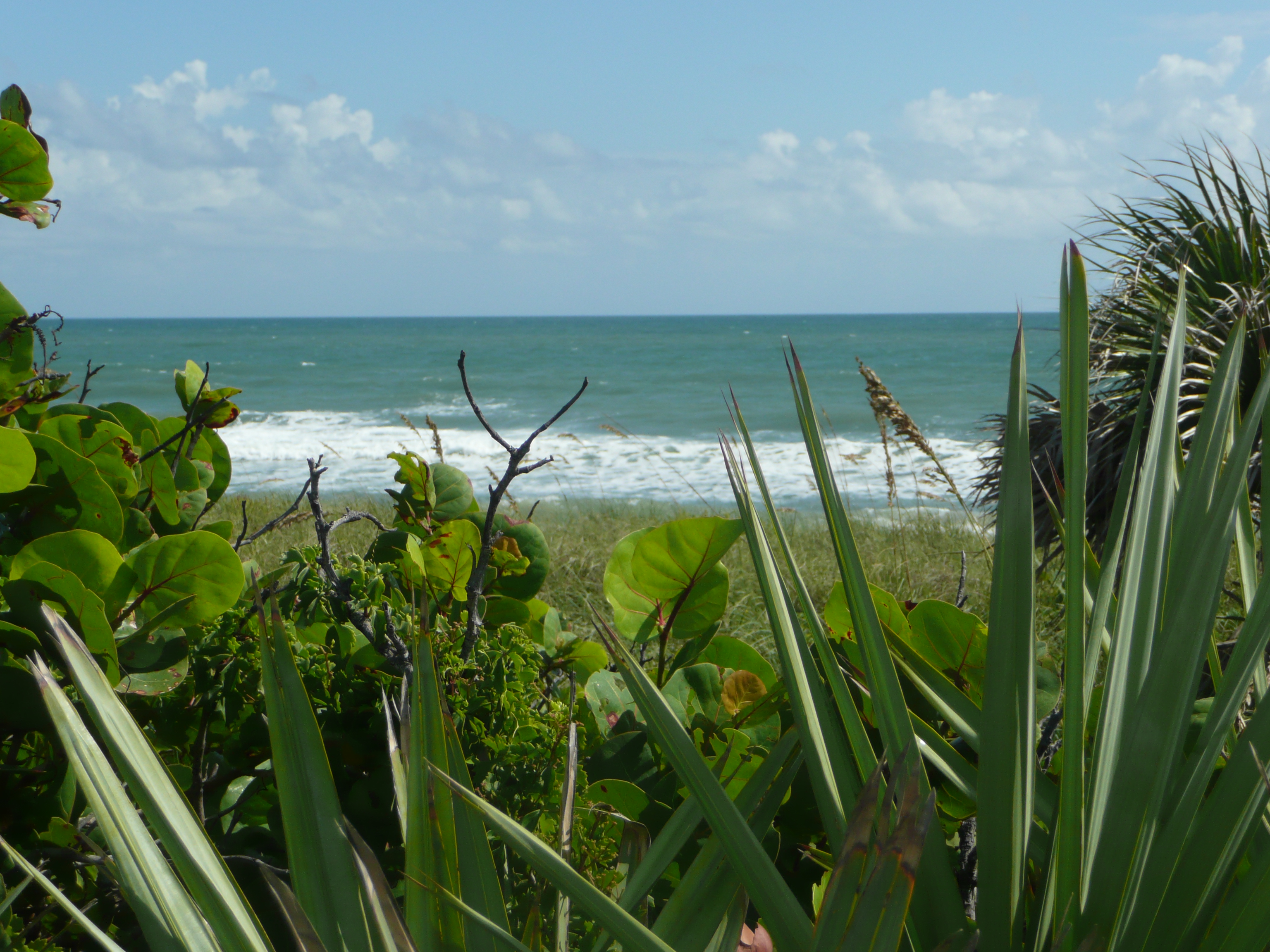
Atlantic Ocean
David: I think Jodi was hooked on the idea of visiting this part of the National Seashore with the mention of, “beach”. Not a big beach “go-er” myself – too much grit, salt and people – I had to admit that the beach here was quite pleasant. No crowds, no cars and no surprises. No surprises except for the disembodied head imploring Jodi to not take his (its?) picture. Jodi and I had come to Parking Area 5 to start our visit. This parking area was at the southern terminus of Seashore’s main access road. We thought that we’d start exploring at this end and work our way back to the main entrance. We were on the wooden boardwalk on our way to get a look at the beach when the bearded “head” appeared and made its pleas to Jodi who had camera in hand. Of course, the head belonged to a gentleman visitor to the beach. He bummed a cigarette from me and it became awkwardly obvious that he would need to borrow my lighter, as well for, in his words, he had “nothing”. Okaaaay. Jodi and I both looked north up the beach as the gentleman departed south. I suppose people express their needs for freedom in a number of ways. If so, this gentleman was certainly expressing his and seemed unconcerned as he walked past a group of surf fisherman toward his ultimate destination. We decided to move to another parking area, just in case there was the possibility of more freedom-expressing individuals. We settled on Parking Area 3 and were soon walking on the beach. It was much the same as my visit of a few weeks prior. In fact, for all I know, it could have been the same four or five individuals fishing and looking for seashells as before.
Jodi: Stop #5 was the end of the road and our first stop. As I began to snap away from the raised walkway, I heard a man say, “Please don’t take my picture.” I jokingly pointed the lens in his direction at my feet. He was standing down on the beach so I could only see him from the neck up. “No! Stop! Please, please don’t take my picture!!” Uhhh… OK? I had no idea who he was and had never seen him before in my life. Truthfully, people are not my preferred subject matter. I looked at Dave who was now handing Mr. Paranoid a lighter. Witness protection maybe? FBI’s Most Wanted? Nope. I’ve seen too many crime dramas. Dave and I now refer to him as ‘Allovertanman’. Read it slowly. All Over Tan Man! Not a stitch. I wondered where he was keeping his keys. Ewww…never mind. Focus!
I will add that our experience was that Mr. Allover was by far the minority. Collectively, everyone else we saw were in various stages of dress or undress depending on whether you are a glass half-full or half-empty kind of person. Maybe he had lost his way. Playalinda Beach is in the South District.
We noticed some fishermen surf fishing and a lady walking on the beach. It was very quiet. The sounds of the breeze blowing the sea oats and palmettos and waves lapping the pristine beach made for a gorgeous site.
David: There was a timeless quality to being on a beach like this…timeless and inviting of reflective moments and speculation. Timeless was in the lives and habits of the various creatures that we observed here. The seemingly endless “to and fro” movements of the sanderlings as they scurried onto the areas wetted by the last receding wave to probe in the sand for a meal and, just as quickly, scurry to drier ground in advance of the next incoming wave. The big gulls doing much the same, but not as afraid of getting their feet wet. The ghost crabs that we detected more by their movement than by an actual sighting until one lingered by its burrow entrance – a seemingly inconsequential hole in the sand. The marked sea turtle nests holding the promise of a new generation to wander the seas and then return to this spot to breed anew. Above all were the brown pelicans flying in formation on wings that never seemed to flap as they flew the length of the beach. They sometimes flew so low over the waves that we wondered whether or not they would get their wings wet. Reflective moments as in remembering coming to Florida and the beaches on vacation as a kid and being amazed at the waves and warmth of the water. Speculation was wondering where some of the things we found washed up on the beach may have come from. Jodi asked me where I thought a battered coconut may have originated. Africa was my first, somewhat hopeful answer. How amazing would that be! Probable? Maybe not so much. Possible? Why not? What about the lost sneaker or the green bottle? One could have speculated on the origins of these items and probably come up with a number of different stories.
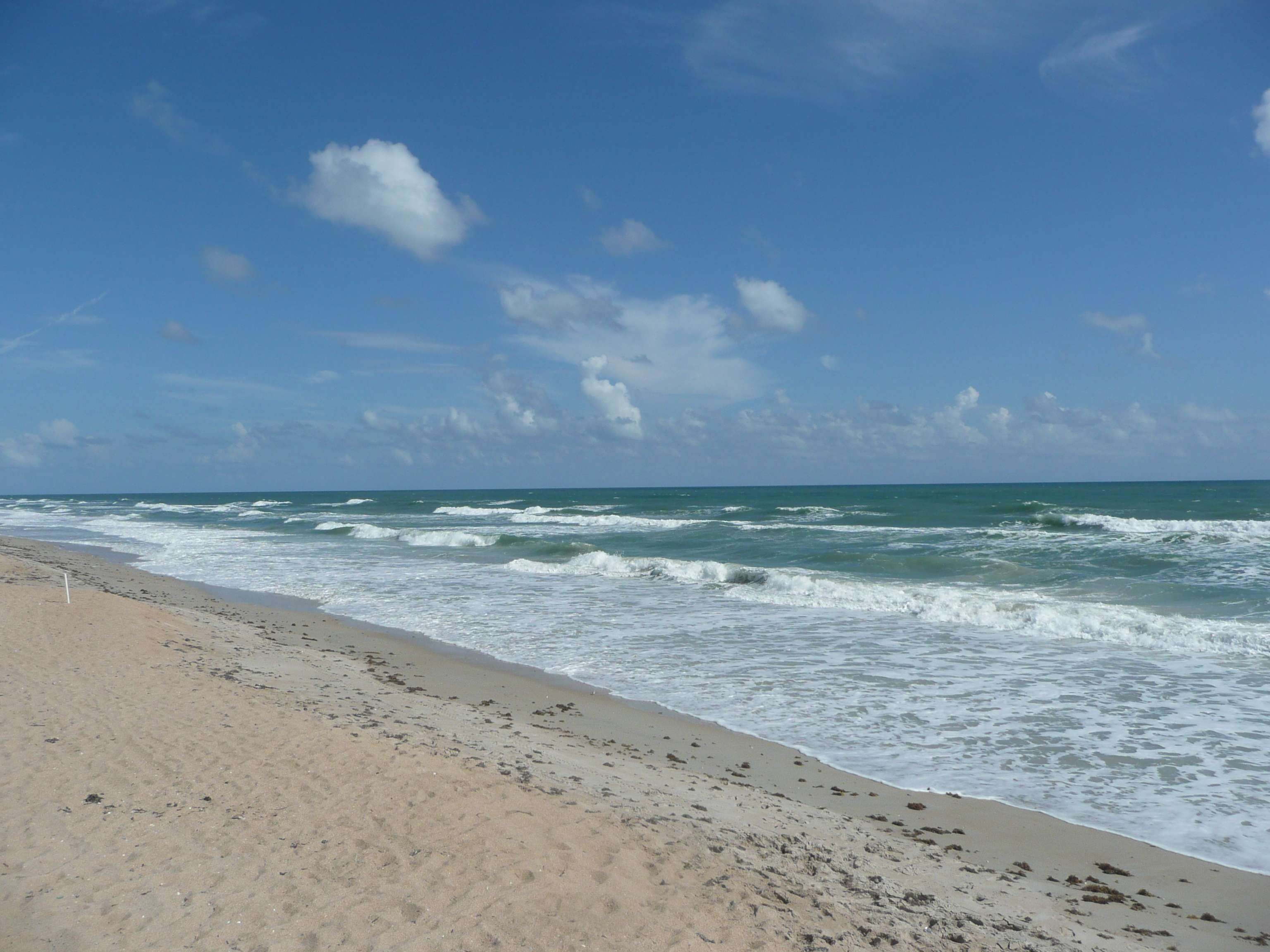
Beach looking North
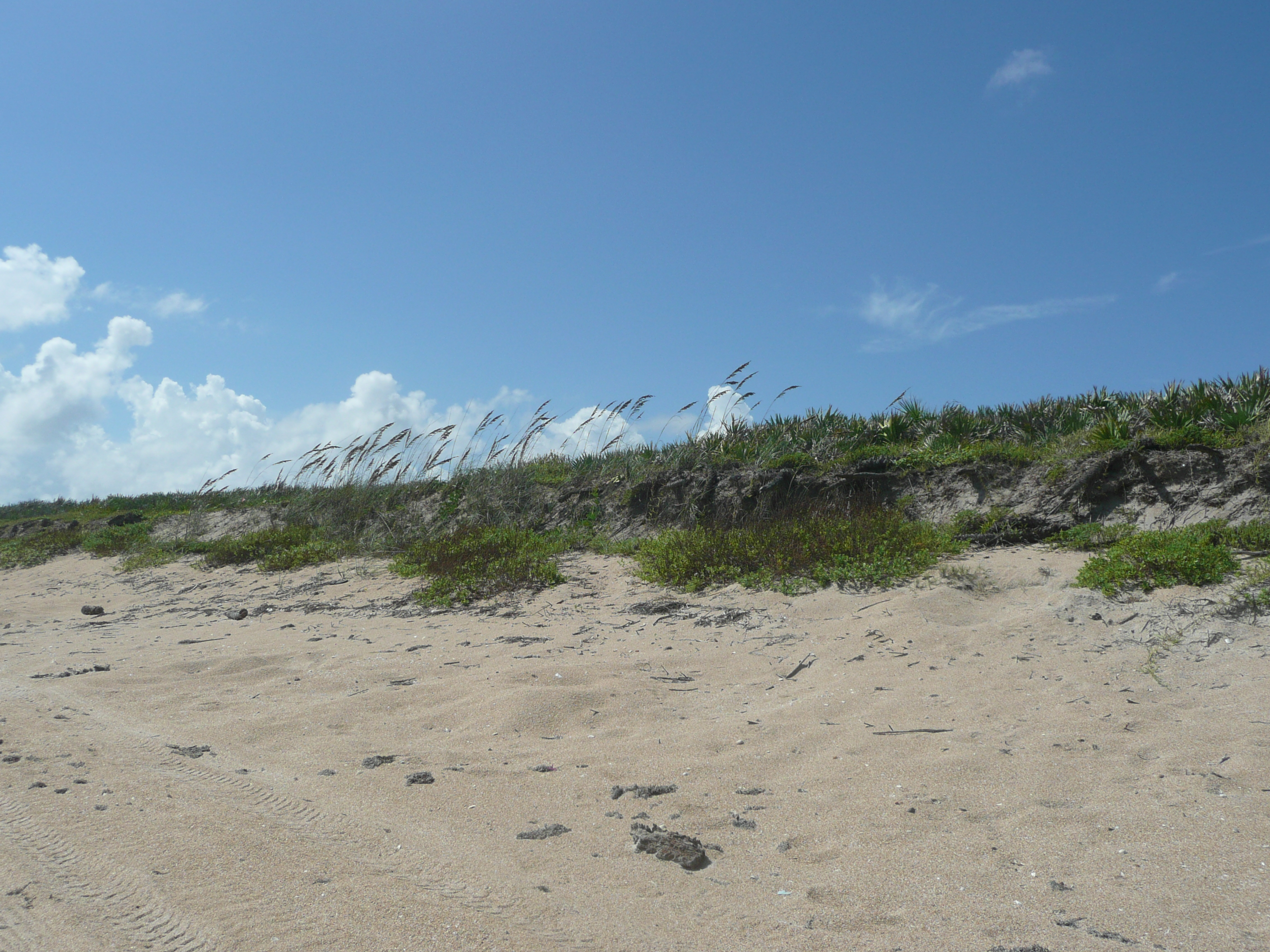
Dune Faces
Jodi: We saw birds like this one running from place to place on the beach. They were fast!
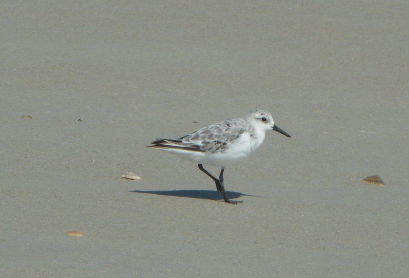
Sanderling
And some sea gulls.
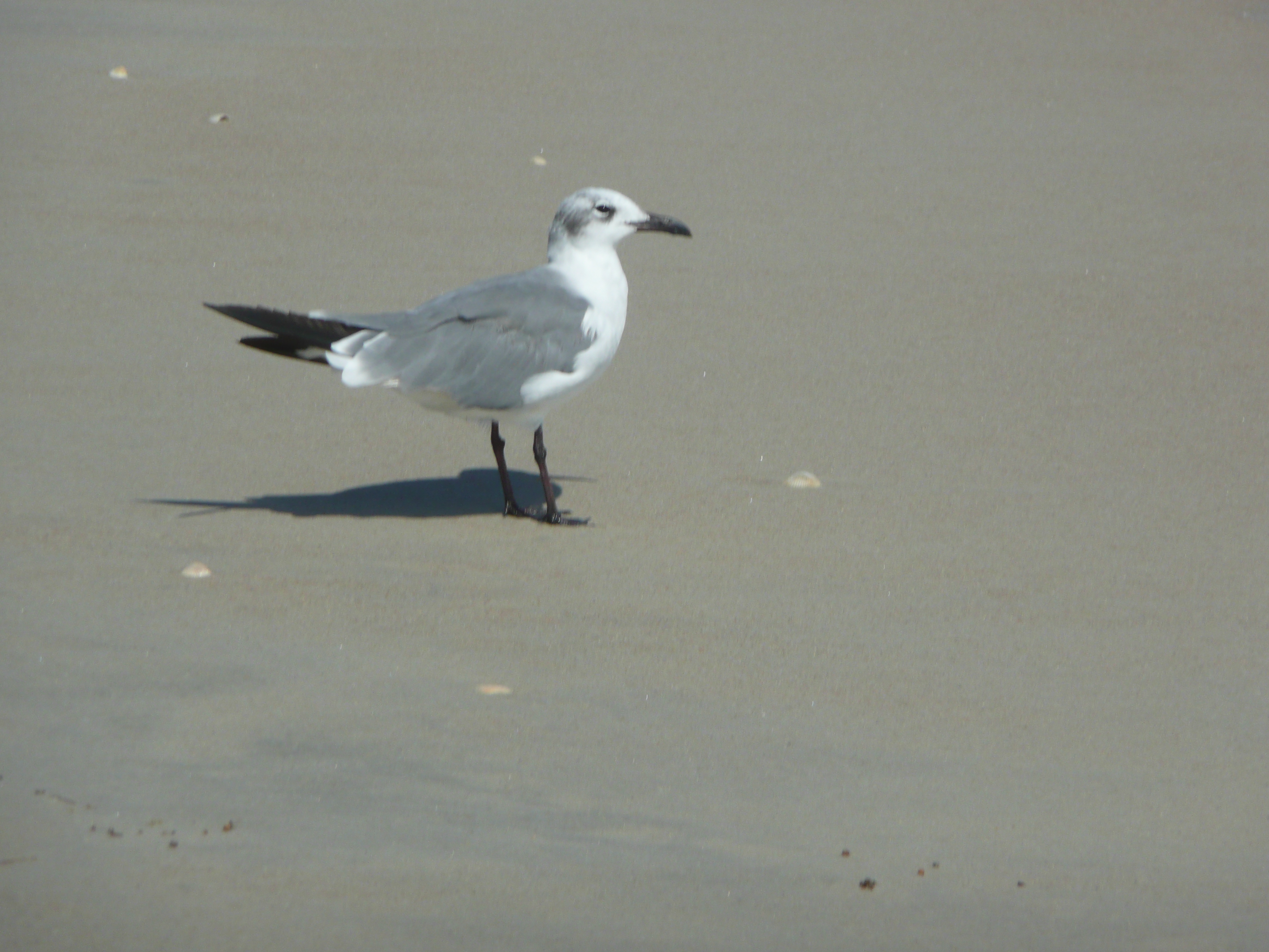
Laughing Gull
Remember the random lime from Lake Ashby? There was a random coconut laying on the beach at CNS.
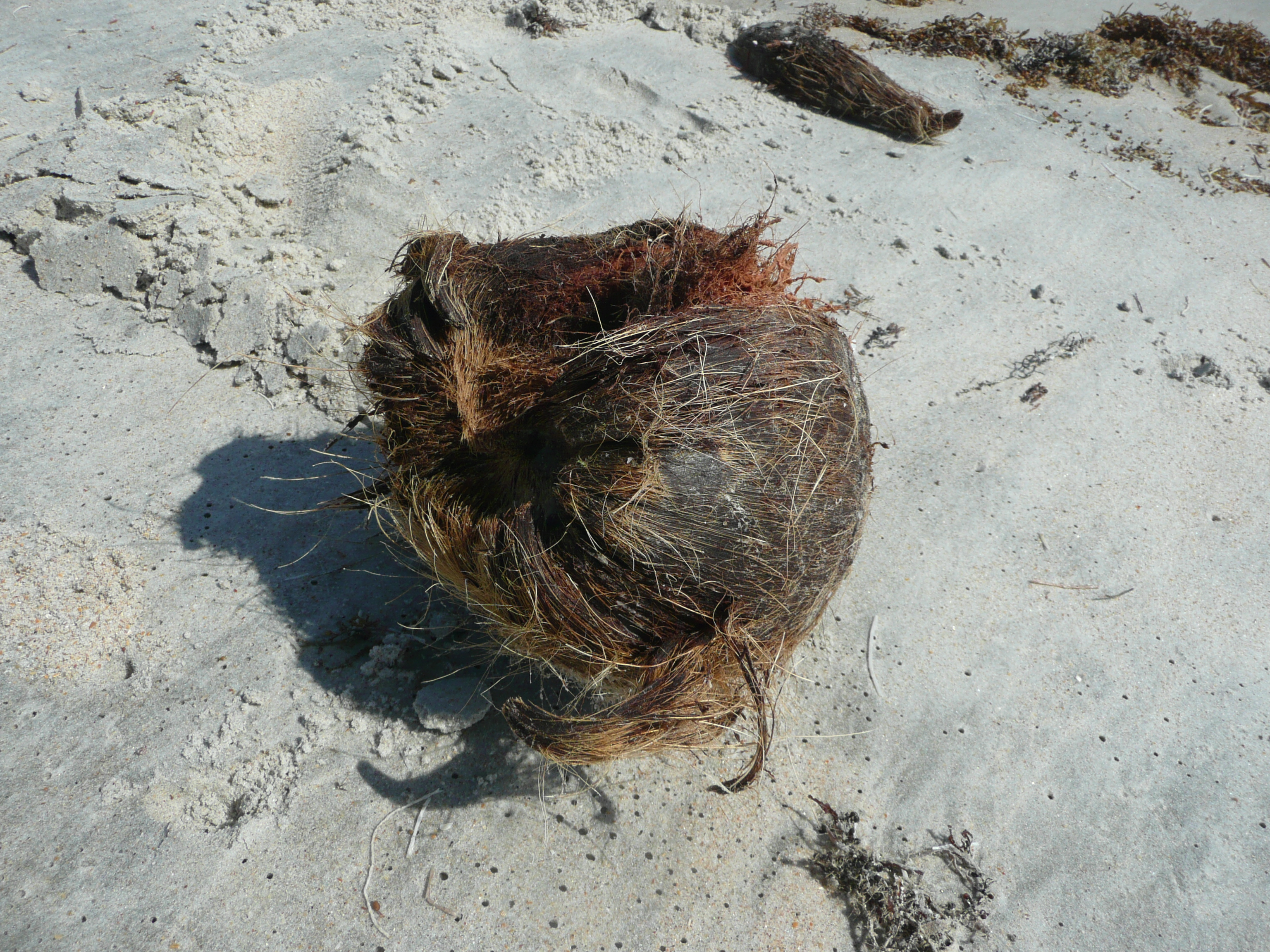
Coconut Husk
Where did that come from? Dave casually says probably Africa. Yeah right. No seriously, he said. Really?!
Here and there as we walked we saw yellow stakes like these with dates and numbers written on them. They indicate the location of a turtle’s nest. Some of the numbers are approximate due dates of the hatchlings.
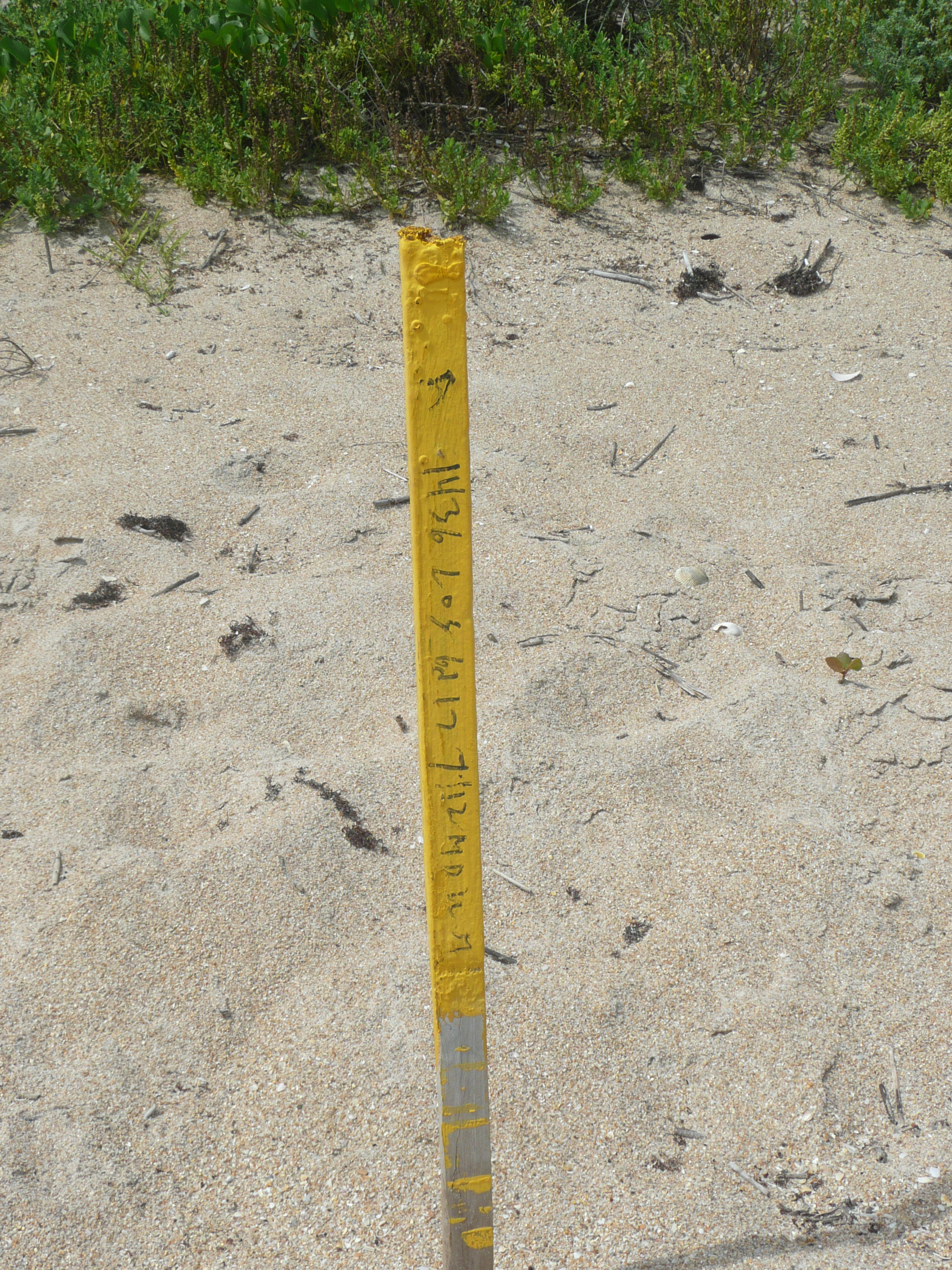
Stake marking sea turtle nest
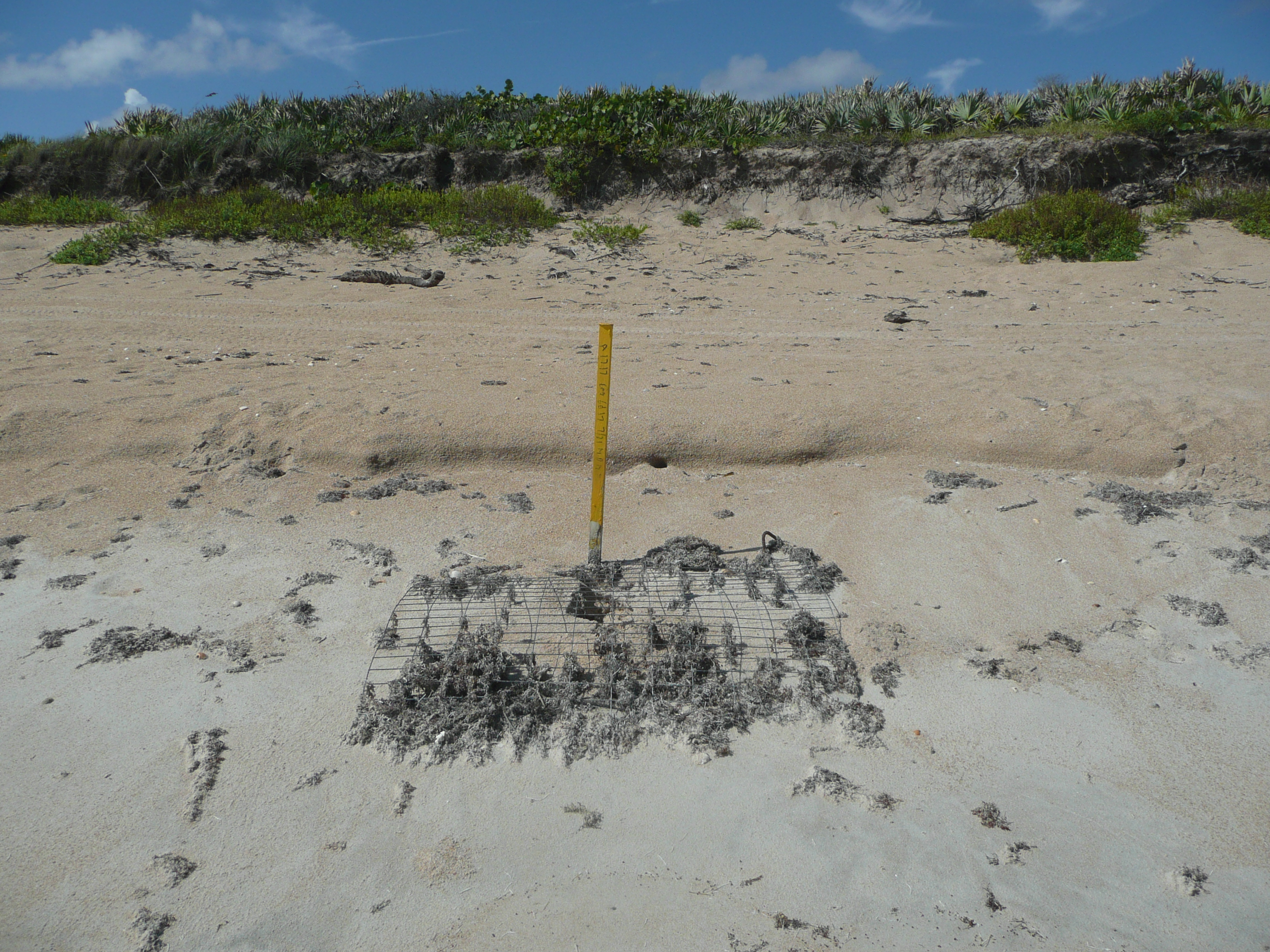
Stake and mesh protection on sea turtle nest
Unfortunately, some beachgoers do not practice the ‘Leave no trace’ rule. This shoe looks like it lost its owner a while ago. See the barnacles?
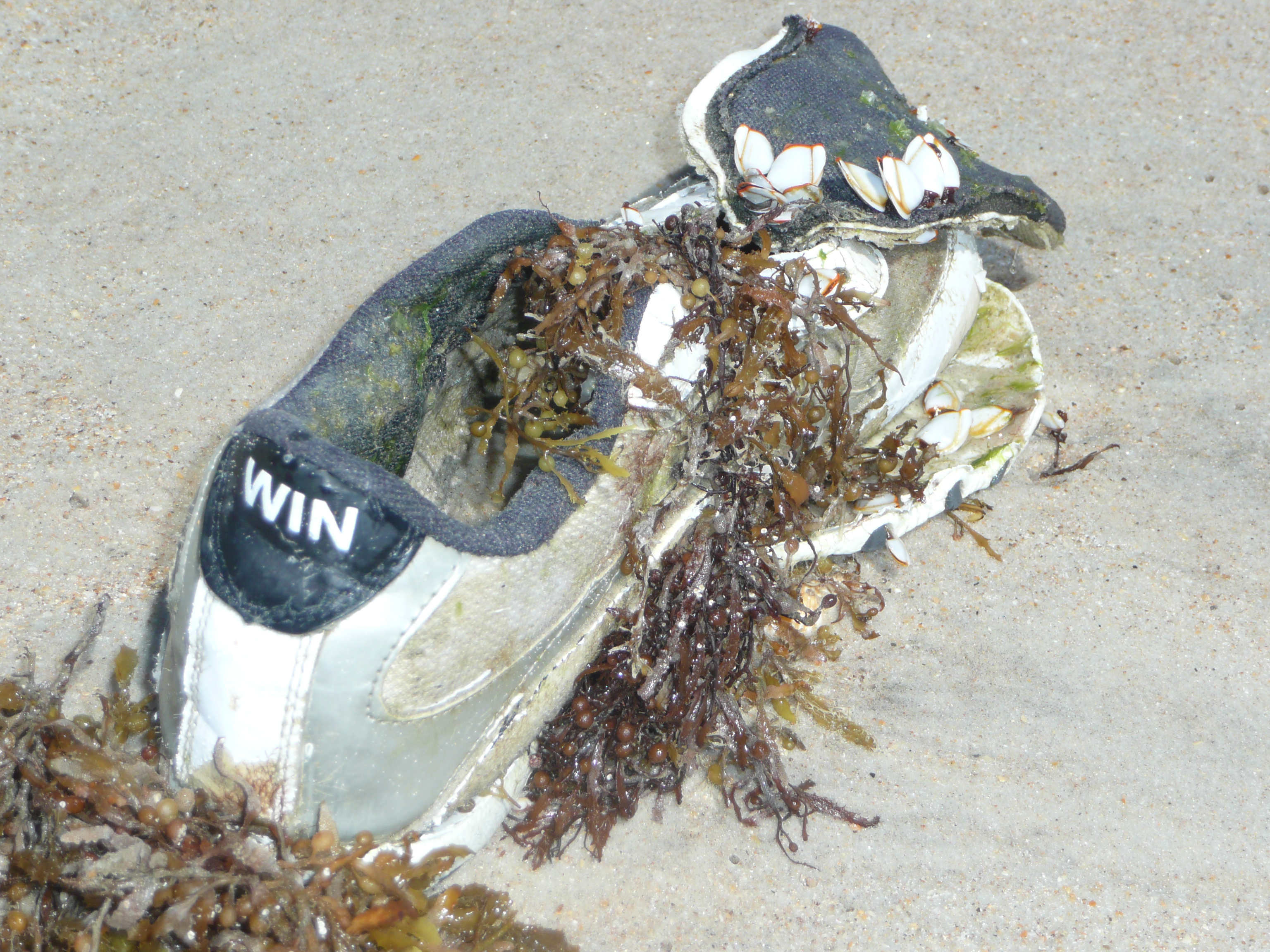
Does the other one say lose?
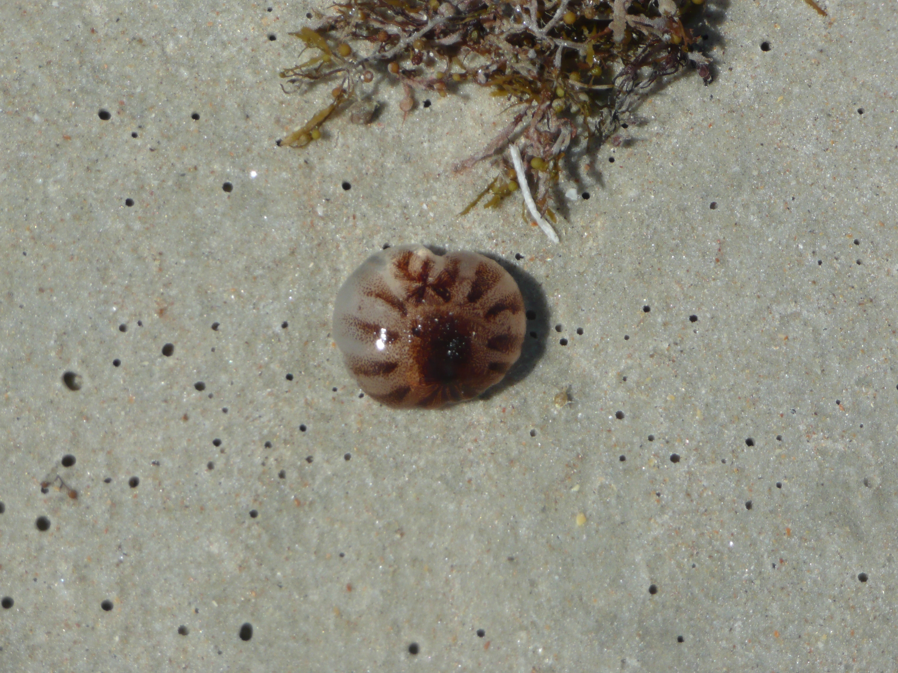
Sea Nettle
We left only footprints as we walked this stretch of Apollo Beach. J
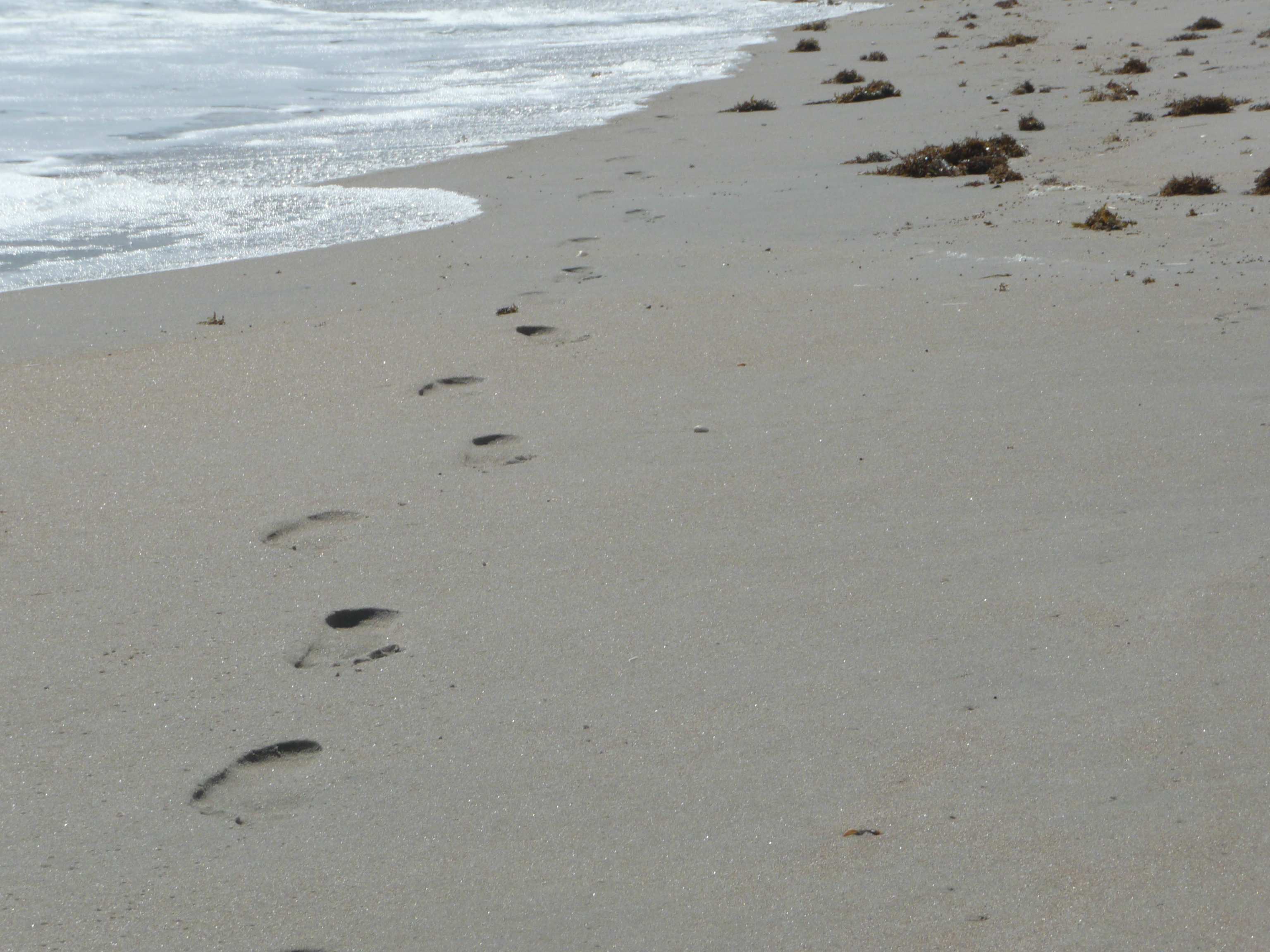
Footprints past sargassum weed
Up the stairs, pics of a few wilds flowers and we’re off to our next stop.
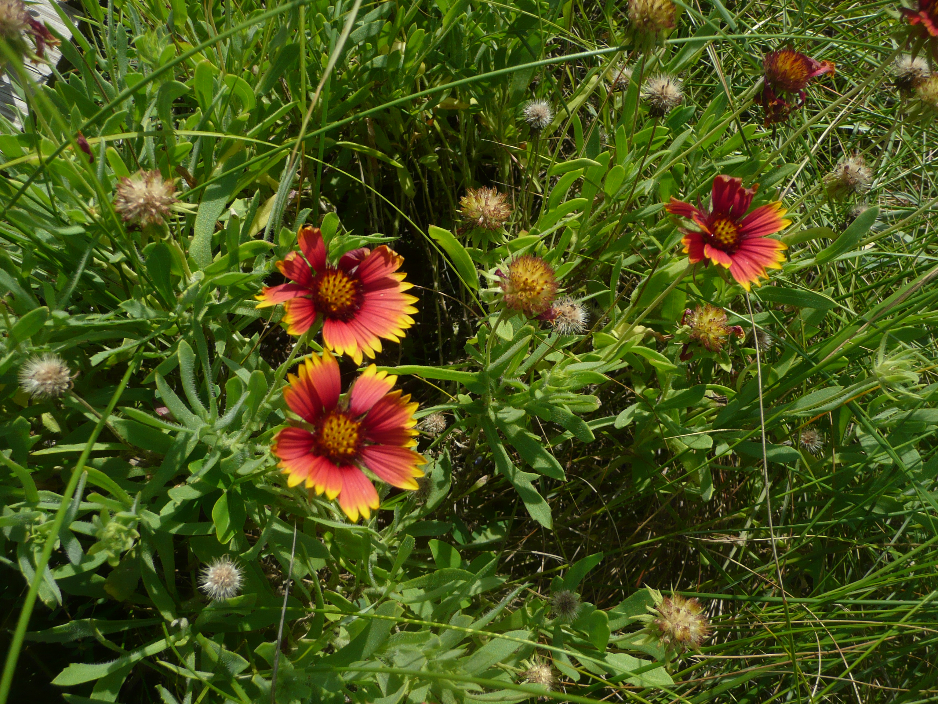
Blanket Flower
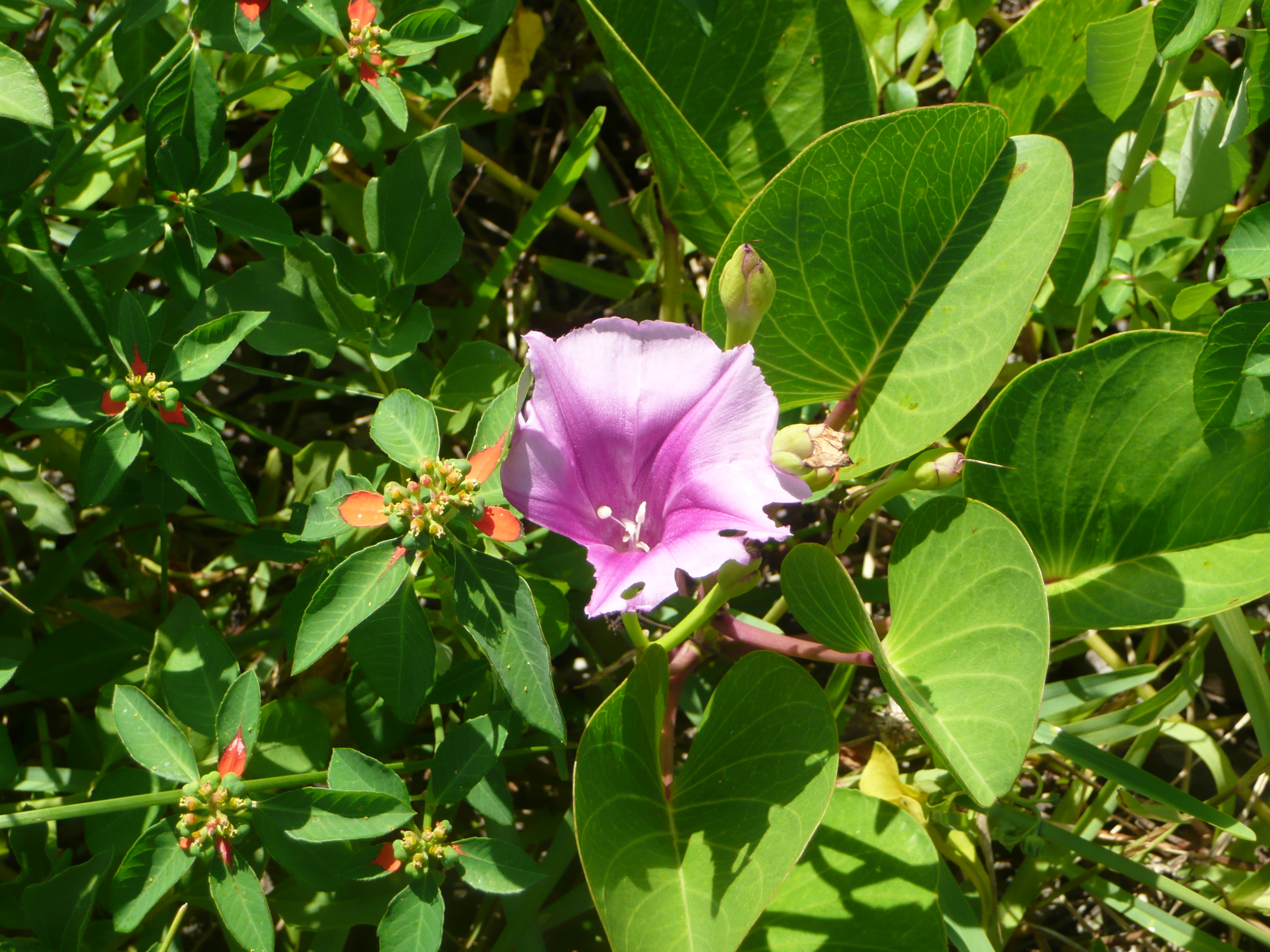
Morning Glory
David: We were on a barrier island and a fairly narrow one. To me, that was one of the most interesting aspects of this part of the Seashore. On the east side was, of course, the Atlantic Ocean. On the west side was the Mosquito Lagoon and a section of the Intracoastal Waterway. Getting from ocean to lagoon was, in one case, a simple matter of walking a couple of hundred feet from one to the other. We decided to make our first stop to explore the lagoon side at Parking Area 3 where the trailhead to the “Castle Windy” trail was located.
Jodi: Water bottles in hand we set off to check out the Castle Windy Trail. Here’s Dave trying to escape the camera lens.
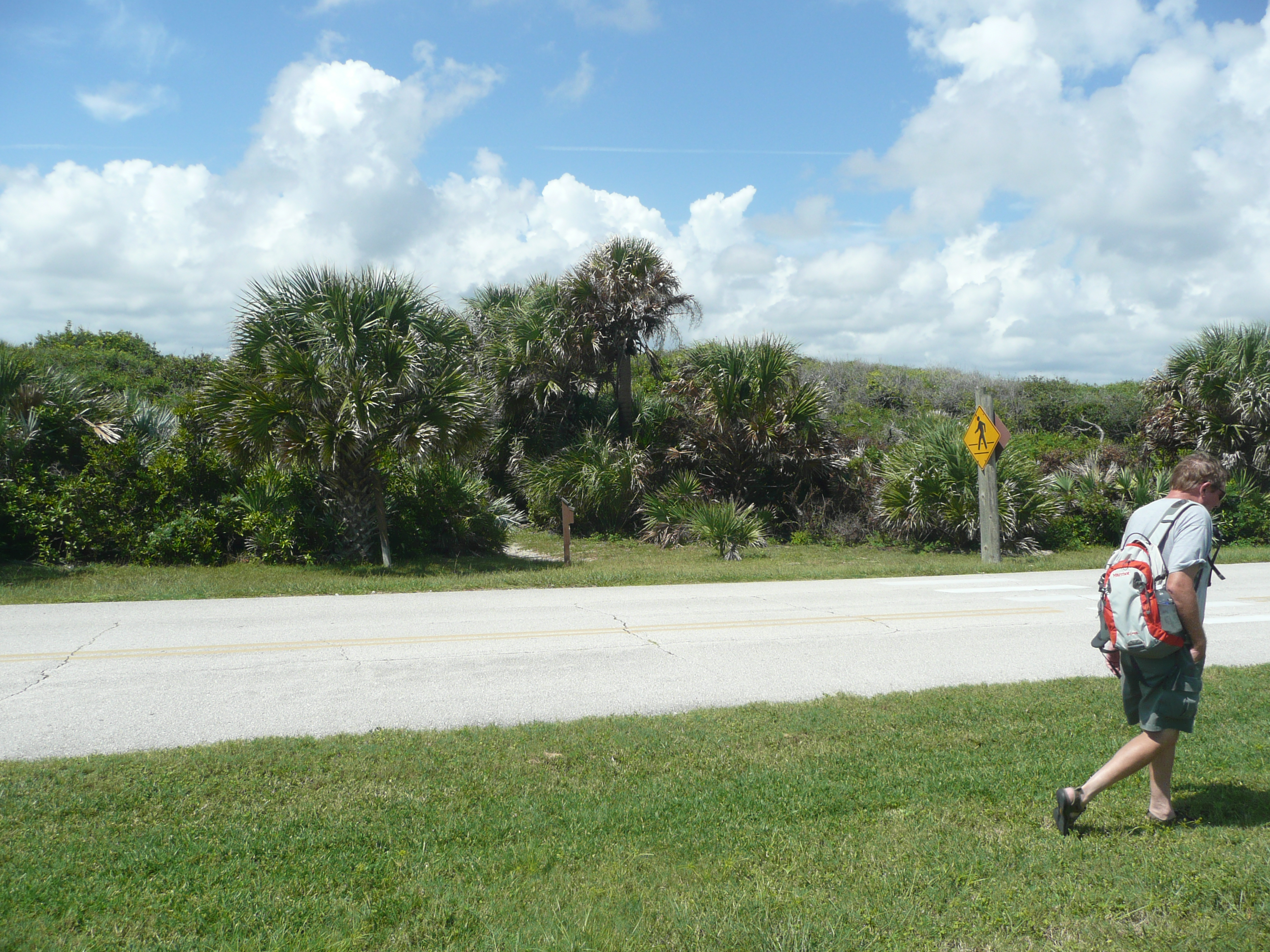
Intrepid Hiker
Through the tunnel of trees we went. If you plan to make this trip, I highly recommend some insect repellent. The mosquitoes certainly thought I was tasty.

Castle Windy trail through coastal hammock
As we walked along the trail Dave pointed out various plants like these below.
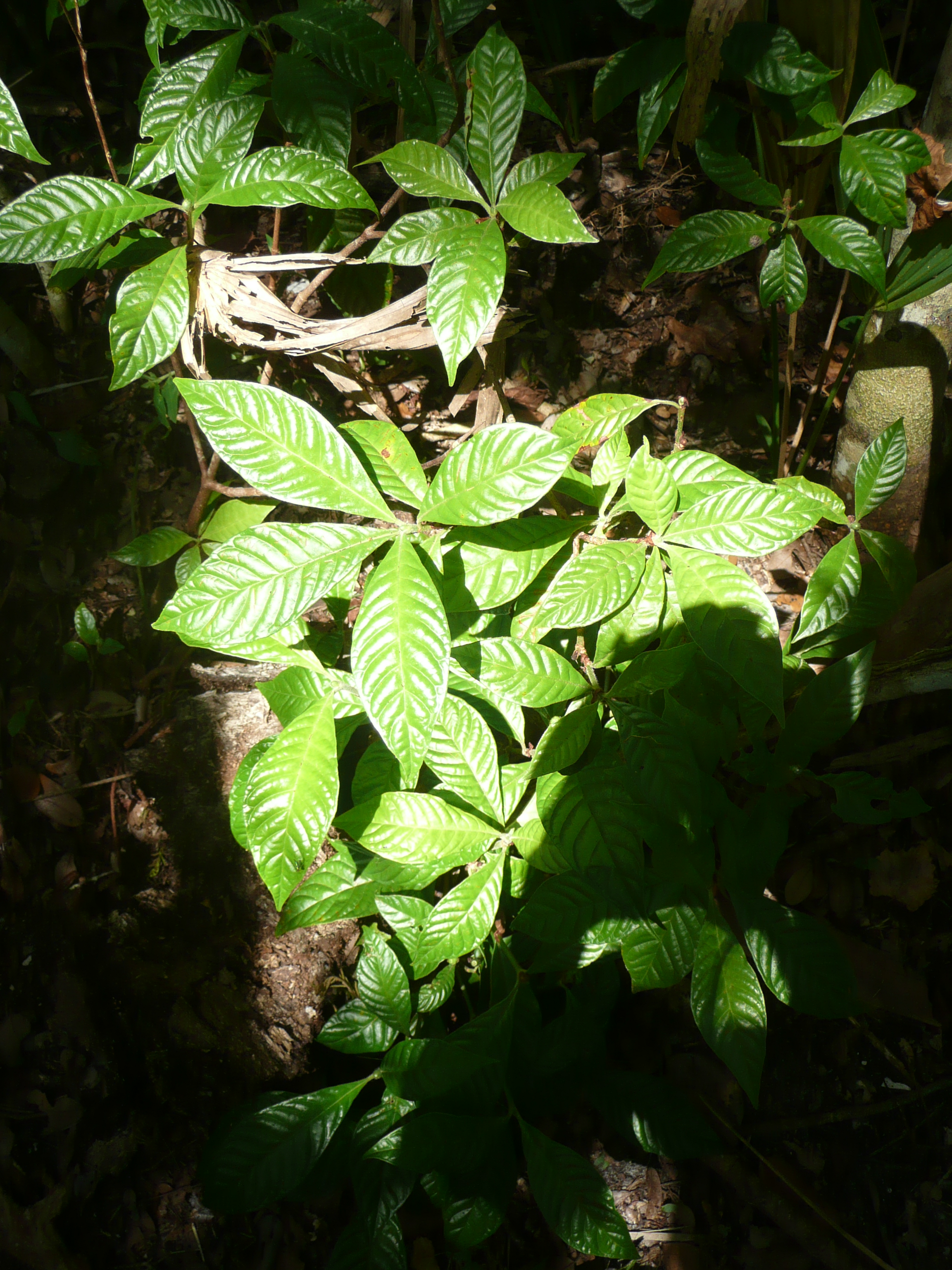
Wild Coffee plant
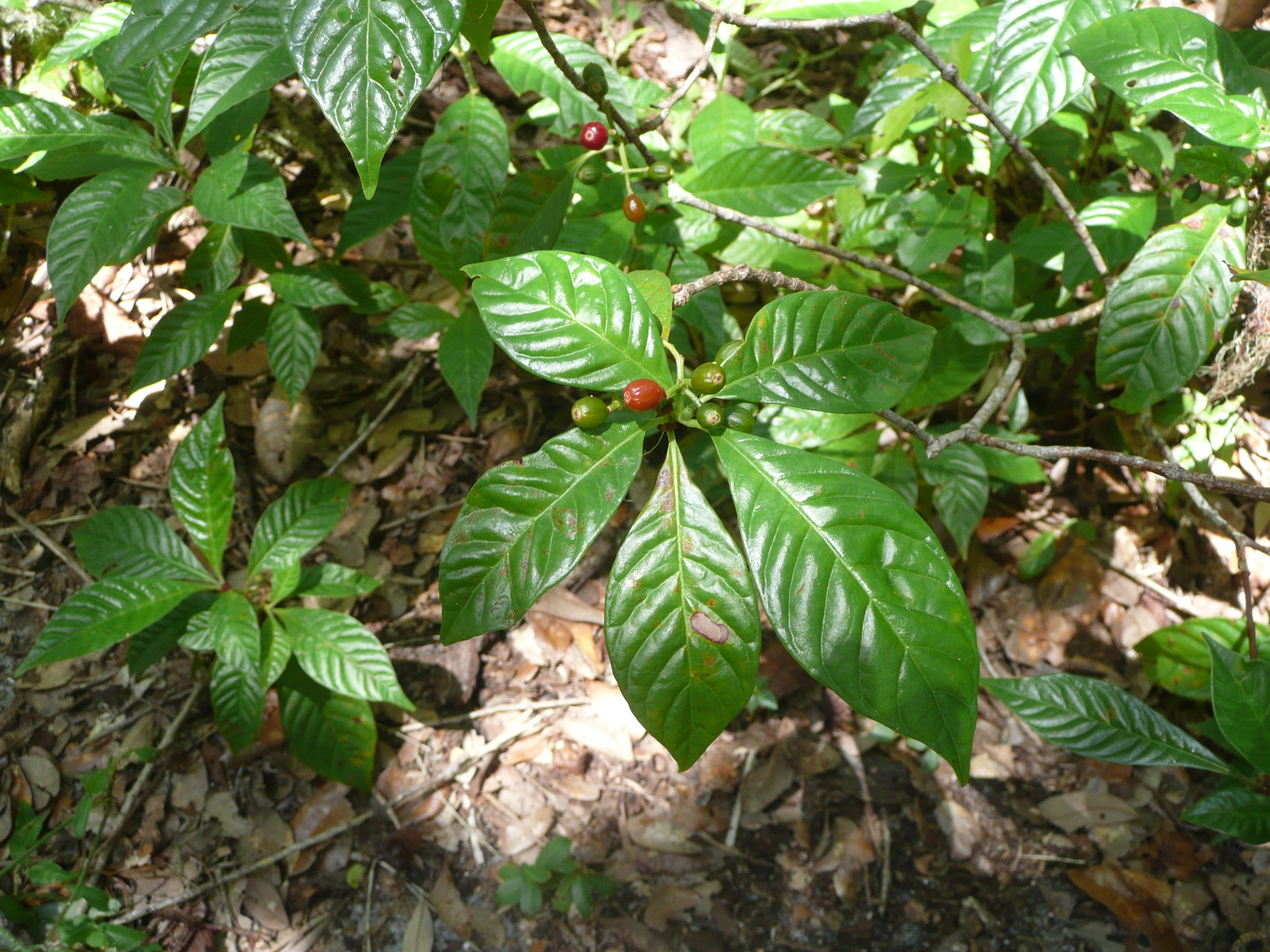
Wild Coffee plant and fruit
Since we’ve started this blog I’ve noticed that I really enjoying chasing butterflies.
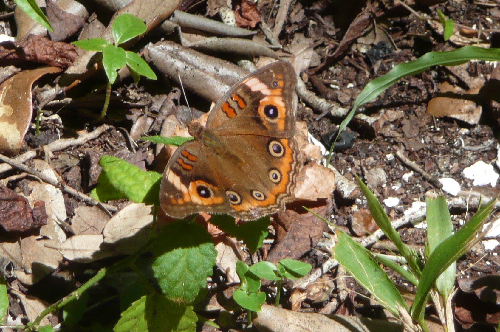
Tropical Buckeye
Who knew the constantly hurried and anxious me would enjoy attempting the patience it takes to photograph these beautiful creatures?
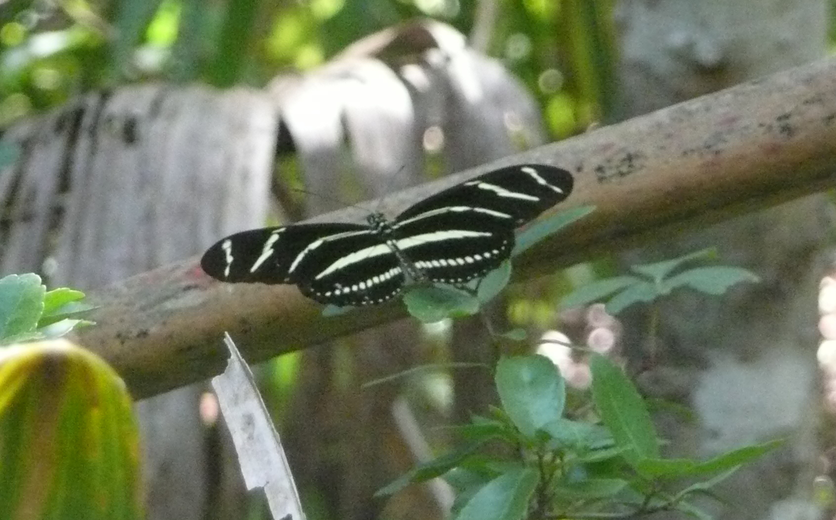
Zebra heliconian
“Do not walk on the Midden” said a sign posted by the National Park Service. How does one not walk on it when one does not know what a “Midden” is? Actually, there was a fence around it.
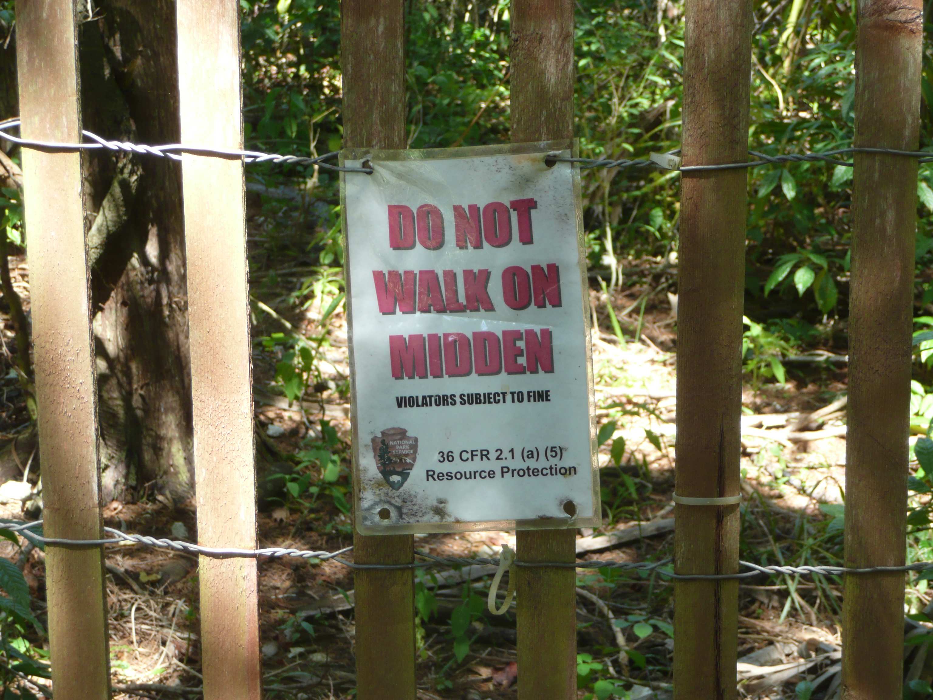
Protective Signage
Of course my inquiring mind wanted to know… What’s a Midden? After Dave gave me a brief description we walked around the last curve of the trail and got a better look at it.
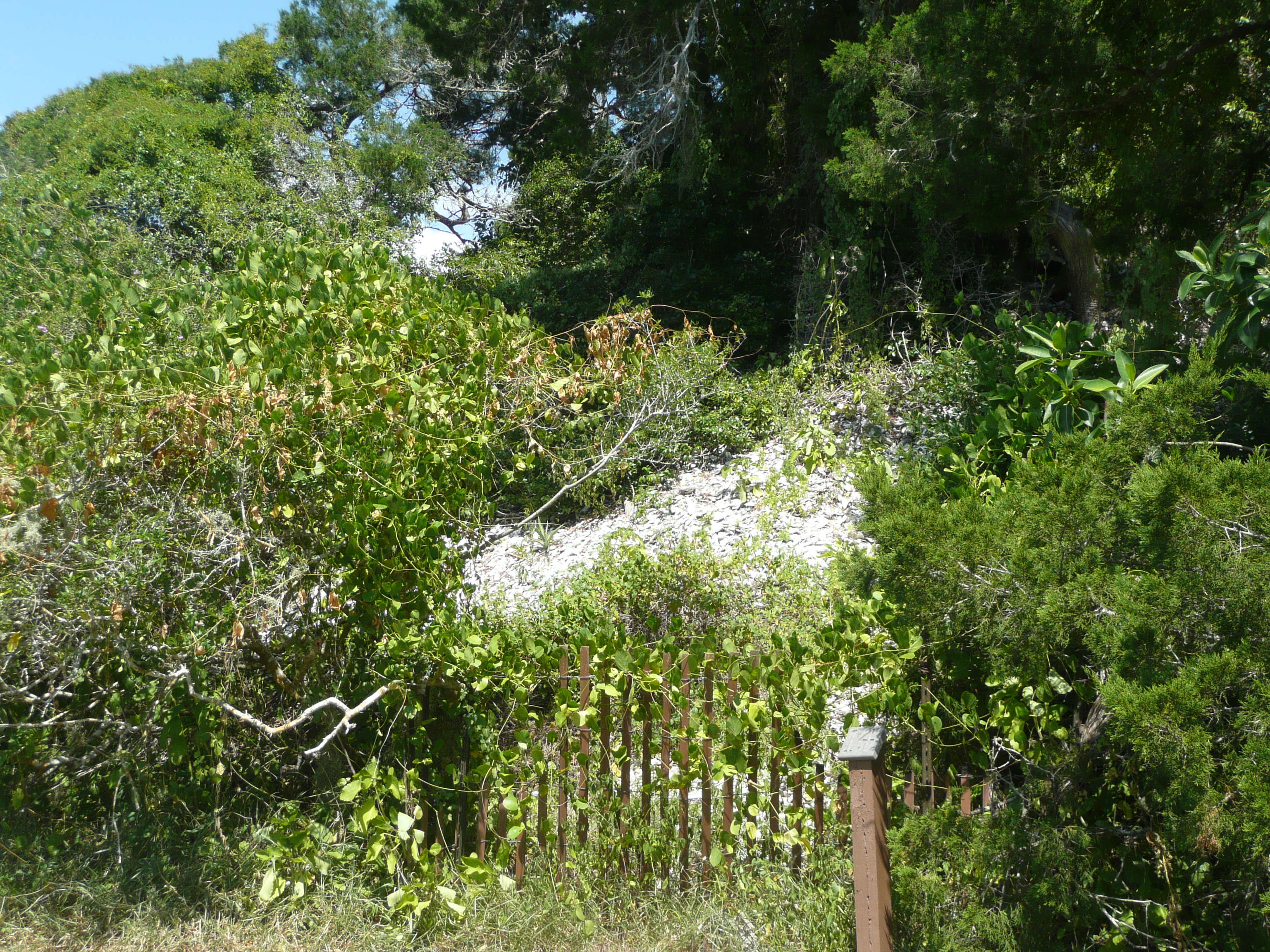
Castle Windy shell midden
Looks like a pile of shells to me. That’s what it is. Later a dictionary I consulted called it a ‘refuse heap.’ Yep, archeological garbage dump from the early Florida settlers. Ever wonder where it all goes when you ‘dump it to crumpit’ as the Grinch says? Now you know. Our piles of iPhones, Kindles, and other gadgets will be studied by our ancestors. Imagine what they will think of what we’ve posted on Facebook and Instagram?! Mr. Allover was lucky that I was polite. They say once it’s on the internet it’s there forever.
So where did this trail take us other than to see the Midden? The beautiful serenity of Mosquito Lagoon where there was a quiet spot to peek through the mangroves. We saw fish jumping. When little fish are jumping there’s a much bigger reason. Big fish? Dolphin? Shark? It was probably bigger fish. However, every time we go to the coast the topic of sharks comes up. I just want to see one in the water. (I know, I should be careful what I wish for…) But it is common to see sharks in the water in this area… I’ve just never seen one.
David: The Castle Windy trail was fairly short in length and easily traversed, but could be considered a “mini-adventure”. The trail spanned the width of the barrier island at this point and took us through coastal hammock with red bay, yaupon holly and Atlantic red cedar to the mangrove-edged shoreline of the Mosquito Lagoon. While the sun was almost completely blocked by the dense vegetation beside and overhead the trail, it was steamy-hot as this same vegetation precluded any hope of a breeze. Insect repellent was not something to be considered casually for anyone walking this trail. As fate would have it, neither Jodi nor I brought any and suffered dearly for it. The mosquitoes attacked en masse and it was nothing to “extinguish” a half-dozen mosquito lives with one well-timed smack! Oh well, lesson learned and penalty paid. The rewards were some great pictures and the relative peace of the lagoon at the end. This end of the trail also had the Indian shell middens known as Castle Windy that are the trail’s namesake. Shell middens were, in essence, refuge heaps for the Native Americans that once carved a life from this area. I’m certainly not versed in any of the history involved with these middens, but can understand and respect the need to protect them. Save for the occasional leaping mullet, there was little “action” observed on the lagoon waters. It appeared that some restorative plantings had been installed along the shoreline along with a barrier constructed of oyster shells. Back to the trail which we traversed a bit quicker this time. We emerged at the trailhead and welcomed the sea breeze which both cooled us and kept any lingering mosquitoes at bay.

Mosquito Lagoon
Jodi: Back through the trail and out to the car we discussed the upcoming weekend. Dave mentioned that CNS would be a great place to bring bicycles. As soon as we were taking in some much needed a/c, I was on the phone to Hubby planning the weekend trip. Stay tuned for that adventure.
David: At some point during the day, we happened to see a bicyclist on the main road. I remarked to Jodi that biking would be a great way to experience this place. A quick call to her husband Jeff and the next adventure was in the works. I guess the plan called for Jeff and me to do the biking while Jodi observed, um, nature from the comfort of a well-placed lounge chair on the beach. I believe a book and beverage selection were also in the plan. We’ll see Jodi!
I asked Jodi if she was up for one last stop. It was pretty steamy and storm clouds loomed to our north. Now, if I could only remember which parking area was the correct one. My goal was the parking area adjacent to a short trail that led to a pier over the lagoon. Was that Lot 8 or 9 or, maybe 7? Making it more interesting, this parking area was off a one-way “loop” road off the main access road. Basically, make a mistake and you have to go all the way around and start over again. I made two. I played by the rules the first time. The second time, well, let’s just say the rules were temporarily forgotten. I was just grateful that an elderly couple in a red sedan did not follow my lead and that I didn’t get caught. I think Jodi just kept her eyes closed!
I finally got things right and pulled into Parking Lot 7. A short walk took us out to the pier which allowed for an excellent vantage point to observe the lagoon. It was almost silent except for the occasional mullet jumping. The water here was, unfortunately, fairly murky. Visibility into it was limited to a very short distance. There was a lone manatee a short distance away. Very white “prop scars” were visible on its back. It was sad to think that such scars are so common on manatees that researchers actually use them to identify individual animals. This one’s movements were almost imperceptible, but it was moving and taking in the occasional breath. We both wished it well. I think I responded “fish food” when Jodi asked me what kind of water insects we observed swarming next to a piling for the pier. I’m normally not much of a bug person, but these little adventures have forced me to expand my horizons a bit. I’m learning new things as I get out the books to identify an unknown bird, plant or insect. There are certainly worse things you can do than learn something new!
Jodi: Parking area #7 was next on our list to check out another trail out to one of the fishing docks. Again we saw beautiful views of the Old Channel leading out to Mosquito Lagoon. This is old Florida at its best! We watched this manatee with scars on its back as it cruised along the shoreline.
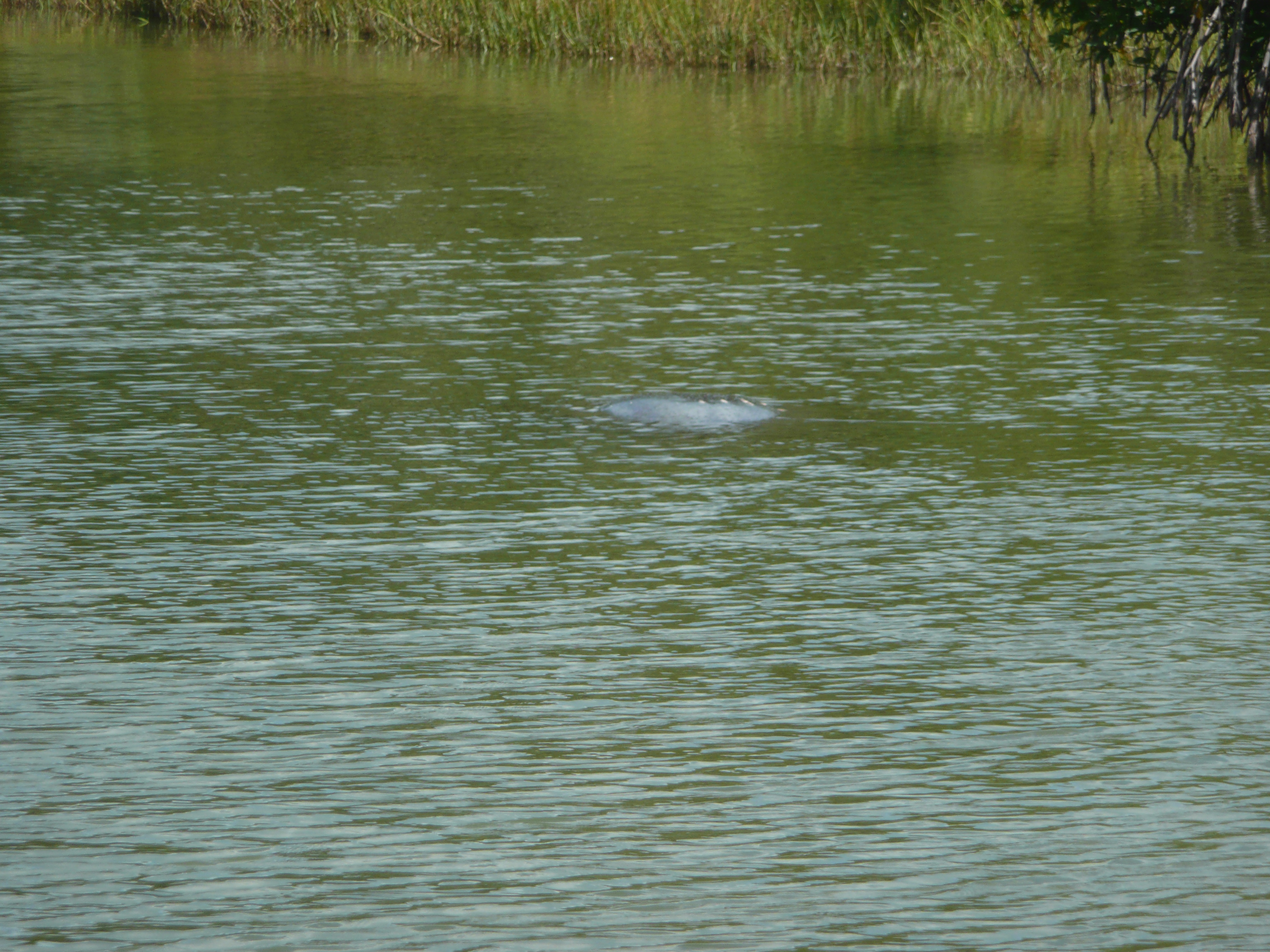
Manatee with visible propeller scars
What are those bugs in the water Dave? Other than fish food.
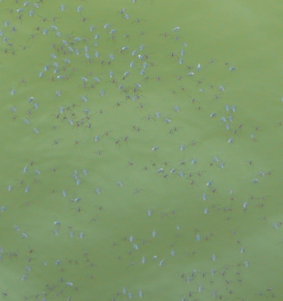
Fish food
Speaking of fish food, I’m hungry. You, Dave? We walked back through the trail to the car. We were sweating profusely from the 90 degree heat of the day. Even we have our limits. It was time for an ice tea and a mahi sandwich. Yum!


Reader’s Comments